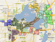


The city of Madison will debut a new interactive map for bicyclists and pedestrians in late summer or early fall. The map is part of an effort to facilitate traffic and improve the channels for public feedback, and city officials provided an update on its progress during a meeting in late June.
“The map is a tool for pedestrians to use to make their own suggestions and see what other people have suggested,” said Jose Navarro, engineering aide for the city of Madison. “The city can use it to see what citizens are saying so they know how to respond to them.”
") Members of the City of Madison’s Pedestrian, Bicycle and Motor Vehicle Commission hold a meeting to discuss a variety of different topics including the progress of a new interactive map (Matt Davis/Madison Commons)
Members of the City of Madison’s Pedestrian, Bicycle and Motor Vehicle Commission hold a meeting to discuss a variety of different topics including the progress of a new interactive map (Matt Davis/Madison Commons)
Suggestions made on the map will generally come from the public. The city can also comment on the map by answering questions from the public.
“The purpose of the map is to allow public input for desired pedestrian and bicycle improvement projects,” said Yang Tao, assistant city traffic engineer for the city of Madison. “It used to be an annual process where people would voice their concerns at an annual public hearing. The new map allows people to continuously update it instead of having to wait for the hearing.”
The The Pedestrian, Bicycle, Motor Vehicle Commission suggested the map, and initiated the idea in part because of the rapid changes in the technology used in traffic management.
“The interactive idea is a way that all technology is going,” said Eric Halvorson, traffic engineering development coordinator for the city of Madison. “It’s part of the city of Madison’s goal of being an open government and we want to get citizen input as easily as possible.”
The project has been in the works for six months, but Tao says they still have a long way to go before finishing the map because they are still improving it and need to obtain additional funding for it.
The public will be able to access the map through the city webpage once the map is completed. The goal is to have a version ready by late summer or early fall.
More importantly, the map is not only designed to aid pedestrians and bicyclists but also to aid the general public.
“I think every opportunity that gives a citizen access to the government in a meaningful and accessible way is very important for the public,” Halvorson said. “The politicians and engineers can only come up with so much, and if we have good suggestions from anyone, it shouldn’t matter where they are coming from.”
|
|
|


Welcome to the Madison Commons, a website designed to provide news and information about all of Madison's neighborhoods and a crossroads for the discussion of community issues. The name comes from the idea of a village commons, a place for news, talk, debate, and some entertainment, too, that's open to everyone.
All rights reserved. Read more about the Madison Commons and its partners.