


The city of Madison may soon see some new redevelopment projects thanks to a $400,000 federal grant from the U.S. Environmental Protection Agency (USEPA) Brownfield Assessment Grant program. The grant is part of a national effort to help develop underutilized or abandoned properties.
The program helps cities perform several steps to identify contamination and develop clean-up plans. Funds cover several stages of investigation, and include the use of environmental consultants.
Initially, the group studied historical maps and public records to identify potentially contaminated areas. Next, the group will test the soil, groundwater, or other areas of each selected property. If contamination is confirmed, the group will perform a larger site investigation. The final stage is to develop a plan for how to best clean up the site, taking into consideration possible use.
The process shifts the high price of investigation away from owners or future developers.
“It can help reduce the initial costs that may hinder development,” said Brian Grady, city planner for the City of Madison.
While more than 200 sites throughout the city were identified as possibilities, Grady estimates the grant will cover ten sites. While the city’s eastside is the first area of focus, properties in the northern and southern regions of the city will also be evaluated.
The city is taking several factors into consideration when choosing what properties to focus on—including environmental contamination, likelihood for redevelopment in the next five years, and input from the community.
Properties must meet the criteria of a brownfield property—defined by the Department of Natural Resources (DNR) as “abandoned, idle or underused commercial or industrial properties, where the use or redevelopment may be hindered by real or perceived contamination.”
The city plans to continue its work with brownfield sites. “We want to develop a stronger program here in the city in regards to brownfields,” said Grady.
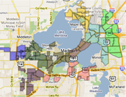
Earlier this year, the city solicited input from residents at a meeting at Lapham School. Each attendee voted for three properties that they would like to see addressed first. Areas near the Yahara River (the properties labeled 11, 14, and 15 on the map) had the most community support.
The city is working with neighborhood planning councils in each section of the city. Joe Mingle, co-chair for the Eastside Neighborhood Planning Council, has been encouraging eastside residents to voice their opinion.
“It is great that they are going to identify places to clean up,” said Mingle. “It has started a conversation about what is the vision for the eastside.”
Mingle notes that these new developments need to be part of a vision for the future of the eastside neighborhood.
“Regardless of which properties the city identifies, this will be positive,” added Mingle.
Residents can suggest properties for the program by contacting Grady at BGrady@cityofmadison.com. For more information on the project, visit the city's Brownfields website.
Attached to this story is a map of recognized Brownfields on the Isthmus (courtesy of the City of Madison).
| Attachment | Size |
|---|---|
| Map of Isthmus Brownfields | 13.44 MB |
|
|
|


Welcome to the Madison Commons, a website designed to provide news and information about all of Madison's neighborhoods and a crossroads for the discussion of community issues. The name comes from the idea of a village commons, a place for news, talk, debate, and some entertainment, too, that's open to everyone.
All rights reserved. Read more about the Madison Commons and its partners.