


") Transfer points were developed to address Madison's rapid growth, but political forces have seen them placed at inconvenient locations (Courtesy photo)
Transfer points were developed to address Madison's rapid growth, but political forces have seen them placed at inconvenient locations (Courtesy photo)
-- The Bus Stops Here is produced monthly by members of Madison Area Bus Advocates
Maybe it is just due to the weariness of having wrangled over the issue of transfer points cum bus hubs for so many years, but the latest five-year Transit Development Plan formally adopted in March and April of 2013 explicitly skirts the issue of transfer point location while focusing on bus stop elimination.
Such judgment appears curious because Madison’s future depends on a healthy, vibrant, public transportation system on par (or better) with what people expect of any progressive, forward-looking urban area. Curious, because current transfer point locations are an acknowledged disaster, whether because of safety and cost, bus routing and scheduling, or a hoped-for future Bus Rapid Transit system.
If the main justification for system changes is that they boost ridership, can one honestly expect that ignoring the unappealing nature of the current transfer points until 2018 at the earliest will boost ridership?
Or maybe the idea is to simply compound one error after another and route buses to bypass the unpopular transfer points rather than making those stops the appealing, vibrant, and bustling places they could and should be? Seriously, people are suggesting this.
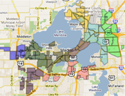
The following is a very brief background into the current placement and condition of the transfer points that were established in July of 1998 after years of wrangling. Those stations are not only pivotal, they are also very different from what was originally proposed.
Madison more than doubled in land area between 1960 and 2010, primarily by annexing undeveloped neighboring land in a short-sighted attempt to add property to the tax rolls while discounting the debt it was acquiring for upgrading and maintaining infrastructure (A map from the city’s 2005 Comprehensive Plan tells the story well). In 1960 Madison had 35.7 square miles of land. In 2010, it had 76.8 square miles of land.
Newer developments tended to use much more space - whereas older Madison neighborhoods might average ten or more people per acre (including everything, not just residences), peripheral neighborhoods might average half or less.
The auto-centric sprawl included the establishment of such peripheral shopping malls as East Towne and West Towne, and the relocation of centrally-located retail, employment centers and warehouses.
Though many planners now might think land use and transportation too interconnected to reasonably consider one without the other, most planners involved in the 2005 Comprehensive Plan did not. Metro planners did of course, linking the peripheral growth to a decline in ridership from 13.8 million passengers in 1981 to 8.9 million by 1989 even as the city’s population grew from 170,616 in 1980 to 190,766 in 1990. If it were to survive, the system had to change from focusing exclusively on downtown.
Metro proposed the location of two hubs along what it called a “transit priority corridor” between the East and West Towne shopping malls. With them, travelers would not have to go all the way downtown to catch a bus going out in a different direction. Metro procured a federal grant for 75 percent of the design and construction cost of hubs envisioned to be “... enclosed, climate-controlled buildings adjacent to bus parking bays” (p. 2). There would be canopies over the boarding areas, enclosed waiting areas, camera monitors, lighting, signs, and landscaping. Just imagine that when it is 5 degrees out!
Plans were for the eastern hub to be in the parking area behind the Madison East Shopping Center and for the western hub to be on Vernon Boulevard between Segoe Road. and Midvale Blvd., an area that stays curiously unused to this day.
The community exploded in opposition. There were the usual objections – traffic, lost parking space, noise, exhaust fumes – but whether said or not was also the stigma associated with the bus: “We are too good to ride the bus and do not want a bus hub located in our neighborhood. Bus riders are predominantly poor, minority, elderly, disabled, or undesirable for some other reason, and we do not want them to congregate close to where we live.”
There even developed a formal Hilldale Area Citizens Committee whose reason for existence was to oppose a bus hub at Vernon Boulevard and a group on the east side to oppose a hub on Winnebago.
The original hub proposal was withdrawn in late 1990, but that did not mean the need for change withdrew as well. Instead, Metro wanted to make a plan that would address as many concerns as possible.
Unfortunately, the lessons learned led to a far inferior set of transfer points that could be described as self-fulfilling prophecy and will hopefully be changed. For one, the sites were away from residential areas although one might think it most convenient to be able to walk over to a major bus hub. “What? Walk, not drive?”
For two, there would be no enclosed waiting area. The comfort and convenience of people who actually ride the bus and need to transfer could not trump the concern of others that enclosed shelters would attract loiterers and vagrants. Why should the comfort of second-class citizen bus riders matter anyway?
For three, other amenities such as bathrooms or comfortable seating would likewise be eliminated to discourage loitering. Discouraging everyone is more like it.
Surely Madison is better than this. It is time to rethink the whole thing.
|
|
|


Welcome to the Madison Commons, a website designed to provide news and information about all of Madison's neighborhoods and a crossroads for the discussion of community issues. The name comes from the idea of a village commons, a place for news, talk, debate, and some entertainment, too, that's open to everyone.
All rights reserved. Read more about the Madison Commons and its partners.